5.1.6. nvector.objects.FrameB
- class FrameB(point, yaw=0, pitch=0, roll=0, degrees=False)[source]
Body frame
- Parameters
- point: ECEFvector, GeoPoint or Nvector object
position of the vehicle’s reference point which also coincides with the origin of the frame B.
- yaw, pitch, roll: real scalars
defining the orientation of frame B in [deg] or [rad].
- degreesbool
if True yaw, pitch, roll are given in degrees otherwise in radians
Notes
The frame is fixed to the vehicle where the x-axis points forward, the y-axis to the right (starboard) and the z-axis in the vehicle’s down direction.
Examples
Example 2: “B and delta to C”
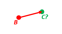
A radar or sonar attached to a vehicle B (Body coordinate frame) measures the distance and direction to an object C. We assume that the distance and two angles (typically bearing and elevation relative to B) are already combined to the vector p_BC_B (i.e. the vector from B to C, decomposed in B). The position of B is given as n_EB_E and z_EB, and the orientation (attitude) of B is given as R_NB (this rotation matrix can be found from roll/pitch/yaw by using zyx2R).
Find the exact position of object C as n-vector and depth ( n_EC_E and z_EC ), assuming Earth ellipsoid with semi-major axis a and flattening f. For WGS-72, use a = 6 378 135 m and f = 1/298.26.
- Solution:
>>> import numpy as np
>>> import nvector as nv
>>> wgs72 = nv.FrameE(name='WGS72')
>>> wgs72 = nv.FrameE(a=6378135, f=1.0/298.26)
- Step 1: Position and orientation of B is given 400m above E:
>>> n_EB_E = wgs72.Nvector(nv.unit([[1], [2], [3]]), z=-400)
>>> frame_B = nv.FrameB(n_EB_E, yaw=10, pitch=20, roll=30, degrees=True)
- Step 2: Delta BC decomposed in B
>>> p_BC_B = frame_B.Pvector(np.r_[3000, 2000, 100].reshape((-1, 1)))
- Step 3: Decompose delta BC in E
>>> p_BC_E = p_BC_B.to_ecef_vector()
- Step 4: Find point C by adding delta BC to EB
>>> p_EB_E = n_EB_E.to_ecef_vector()
>>> p_EC_E = p_EB_E + p_BC_E
>>> pointC = p_EC_E.to_geo_point()
>>> lat, lon, z = pointC.latlon_deg
>>> msg = 'Ex2: PosC: lat, lon = {:4.4f}, {:4.4f} deg,  height = {:4.2f} m'
>>> msg.format(lat, lon, -z)
'Ex2: PosC: lat, lon = 53.3264, 63.4681 deg,  height = 406.01 m'
- __init__(point, yaw=0, pitch=0, roll=0, degrees=False)[source]
Initialize self. See help(type(self)) for accurate signature.
Methods
Pvector(pvector)Returns Pvector relative to the local frame.
__init__(point[, yaw, pitch, roll, degrees])Initialize self.
Attributes
R_ENRotation matrix to go between E and B frame